Hiking Mt. Asahidake In Hokkaido | 100 Famous Japanese Mountains
You are here:
- Home
- Hiking in Japan
- Hiking Mt. Asahidake In Hokkaido…
On our quest to climb all 100 famous Japanese mountains or 日本百名山 (Nihon Hyaku-meizan) as they are known in Japanese, we made our way to Mt. Asahidake, located within the Daisetsuzan National Park in the centre of the northern Japanese island of Hokkaido. Daisetsuzan is Japan’s largest national park spanning 2268 square kilometres and Mt. Asahidake is Hokkaido’s highest peak sitting at 2291m.

There are numerous access points to the Daisetsuzan national park and many different hiking routes available ranging from day-hikes to multi-day hikes. There are actually three of the 100 famous Japanese mountains located within the Daisetsuzan national park (Mt. Asahidake, Mt. Tomuraushi and Mt. Tokachi) and it’s possible to summit all of them if you plan a multi-day hike and camp or stay in huts along the way.

Mt. Asahidake has a very short climbing season since snow melts in June and reappears in late September. The peak hiking season is during the months of July and August. The weather can also be extremely changeable so it’s really important to be well-prepared for cold weather, rain and snow if you plan on doing this hike.
We started our hike up Mt. Asahidake from Asahidake onsen via the Nakadake-onsen route and camped near the summit. We will share our experience of hiking Mt. Asahidake below.
The information and photos we share in our 100 famous Japanese mountains blog posts is the type of information we wish we could have known before doing the hikes ourselves!

Name: Mt. Asahidake (旭岳)
Location: Hokkaido
Height: 2291m
Time: 7.5 hours (4 hours up and 3.5 hours down via the Nakadake-onsen scenic route) OR 2.5 hours up and 1.5 hours down via faster route)
Difficulty Rating: 3/5
Trail Head: Daisetsuzan Asahidake Ropeway (see map below)

The easiest way to access Mt. Asahidake is from a town called Asahidake onsen, which is located around a one hour drive from Hokkaido’s second largest city Asahikawa. There are buses running from Asahikawa to Asahidake onsen, however they are only a few per day so it’s more convenient if you have your own transport.
There is a cable car leaving from Asahidake onsen which carries passengers to Sugatami ropeway station at an elevation of 1600m. Click here to access the cable car website for pricing and scheduling information. There is free parking at the cable car station and at the visitor centre in Asahidake onsen town.
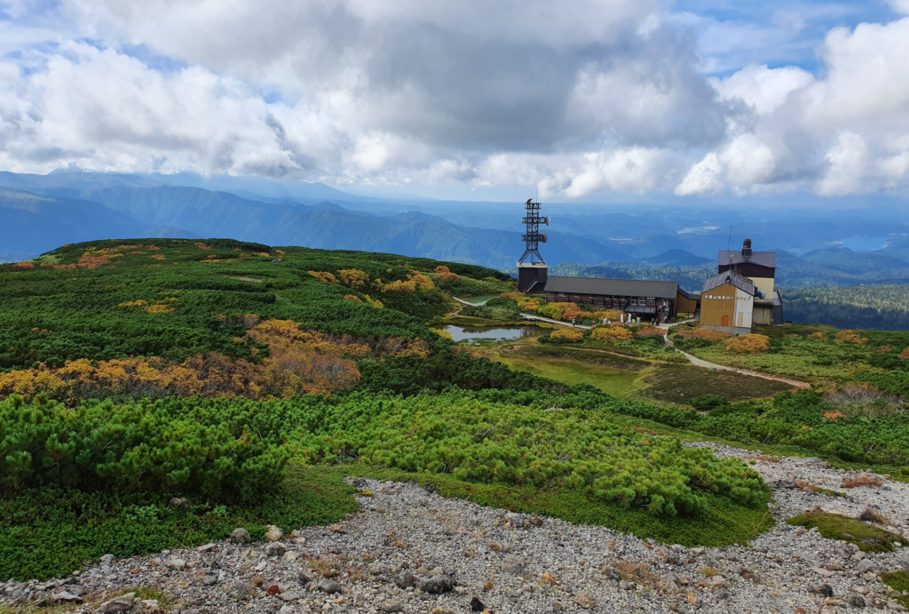
It’s also possible to hike up Mt. Asahidake without taking the cable car. We met a man at the summit of Asahidake who had set off in the dark before the cable car started since he wanted to be at the summit for sunrise. Not taking the cable car will add an extra 2 hours onto the hike.
There are a variety of accommodation options in Asahidake onsen town and it’s a nice place to stay for a night to two before and after hiking since you can enjoy the natural onsen water and rest your tired feet after a long day of hiking.
We took the cable car from Asahidake onsen and it took around 10 minutes to reach Sugatami cable car station located at 1600m. Many people take the cable car to this point so they can enjoy the view of Mt. Asahidake in the distance before taking the cable car back down again.
The cable car is especially busy in mid-September when the autumn leaves start to change colour. It’s said that the area surrounding Mt. Asahidake is the first place in Japan to experience autumn leaves each year.

From Sugatami cable car station, there are two routes to reach the top of Mt. Asahidake. It’s possible to do a circuit route and combine these two routes if you prefer not to hike the same route on the way back but it’s necessary to start early if you plan to do this.
People who do the circuit tend to summit Mt. Asashidake first then pass by the wild onsen before heading back to Sugatami cable car station.
The quickest route to the summit of Mt. Asahidake from the Sugatami cable car station is via the Sugatami pond and takes around 2.5 hours up and 1.5 hours down.

However, we decided to take the longer and more scenic Nakadake-onsen route since the autumn leaves were in full force and we wanted to see the wild onsen. It takes around 4 hours up and 3.5 hours down if you return via the same route.
It’s really easy to get lost while hiking in the Daisetsuzan national park, especially if Japanese is not your first language since there are many different paths and Japanese signposts.
Before setting off on your hike, it’s very important to know exactly where you will be going and it’s recommended to purchase a map from the visitor centre in Asahidake onsen town. We saw a photograph in the nature centre of a hiker who had gone missing earlier in the year.
It’s also possible to encounter bears while hiking in the Daisetsuzan national park, so don’t forget to carry a bear bell and bring bear spray.

We arrived at Sugatami cable car station located at 1600m and followed the signposts for the Nakadake-onsen route. There are some beautiful lakes located near the cable car station and there were many people there taking photos.
There is a short 1-hour walk around the lake which is popular with families and non-serious hikers. Once you start hiking on the Nakadake-onsen route, the crowds will thin out.
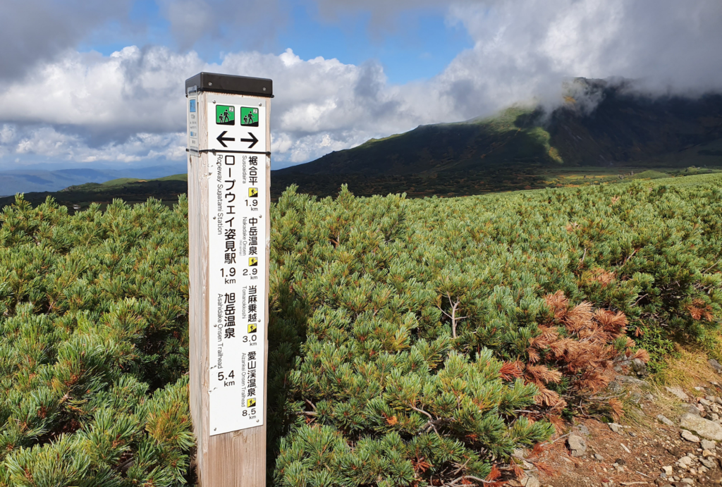
We hiked in mid-September and the autumn leaves were incredible. If you can hike during this time, it is definitely recommended.
The Nakadake-onsen route is very flat for the first 2 hours and the path is well-trodden. The flat area between the cable car station and the wild onsen is the place hiker’s are most likely to encounter a bear so please take care during this part of the route.

After hiking for around 1 hour, there is a flat area with some benches where many people choose to have lunch. After this rest area, there are boardwalks which have been installed since the ground below can be quite wet and muddy.
The boardwalks were in quite bad condition when we visited in September 2020. The area with the boardwalks is the best area to see the autumn colours and the path is easy to follow.
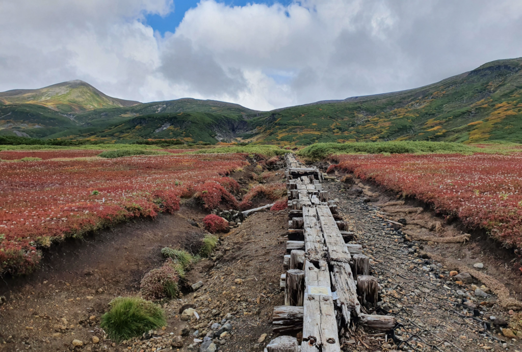
After another 1 hour of hiking, the boardwalks finish and there is a rocky gully area with a river and you can start to smell an eggy onsen smell.
After hiking through the rocky gully area for 10 minutes, a small wild onsen will appear and near the wild onsen is a toilet room where portable toilets can be used. The onsen is usually used as a foot onsen but it is possible for one person to fit their whole body inside.
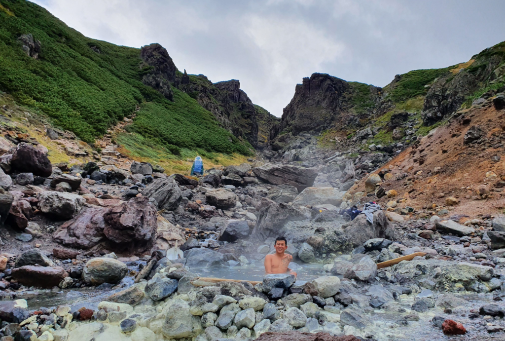
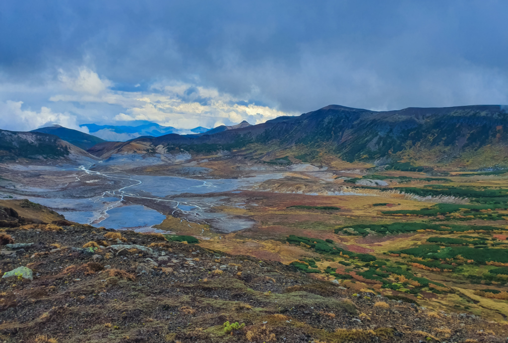
After the onsen, the path becomes steeper and if the weather is good, the views over the Daisetsuzan national park are incredible.

After another 45 minutes of hiking, there is a junction and if planning on summiting Mt. Asahidake, it’s necessary to turn right. The path to the left heads in the other direction towards Sounkyo onsen town, another popular access point to the national park.
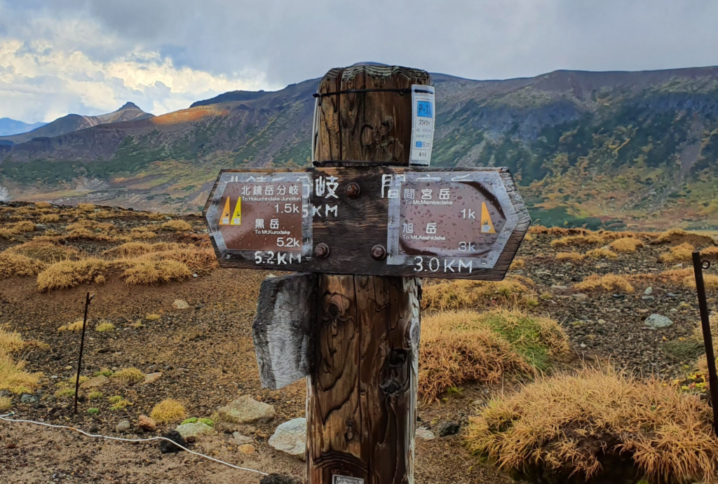
After this junction, the next 45 minutes of the path is uphill and easy to follow. The views over the national park on the left side of the path are superb, the landscape looks like something from another planet.
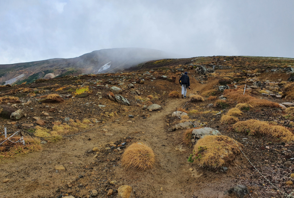
You will pass the summit of Mt. Mamiyadake at 2185m and then arrive at another junction. It’s necessary to turn right at this junction and this is the final stretch towards the campsite and the summit of Mt. Asahidake. Turning left is the route people take when they are doing multi-day hikes through the national park.


It takes approximately another 45 minutes to reach the campsite. The campsite sits in a hollow under Mt. Asahidake and each camp spot has been marked out using a stone wall to protect tents from the wind.
From the campsite, it’s a 20-30 minute steep hike over loose volcanic rocks to the summit of Mt. Asahidake.
From the summit of Mt. Asahidake, you can return via the same route (3.5 hours) or head down the popular route (1.5 hours) to the Sugatami cable car station that most hikers take.
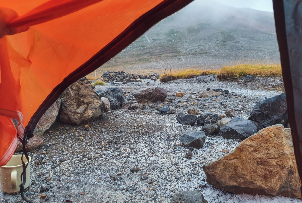
The campground is free to use and has no toilet or facilities. As mentioned above, the spots for tents to be pitched are marked by small stone walls which protect tents from the wind. We read that there is a water source located near here, but we couldn’t find it when we stayed overnight.
It was a very cold night with hailstones when we visited and the temperatures reached below zero. We recommend bringing a very good sleeping bag and warm clothes if you plan to camp here.
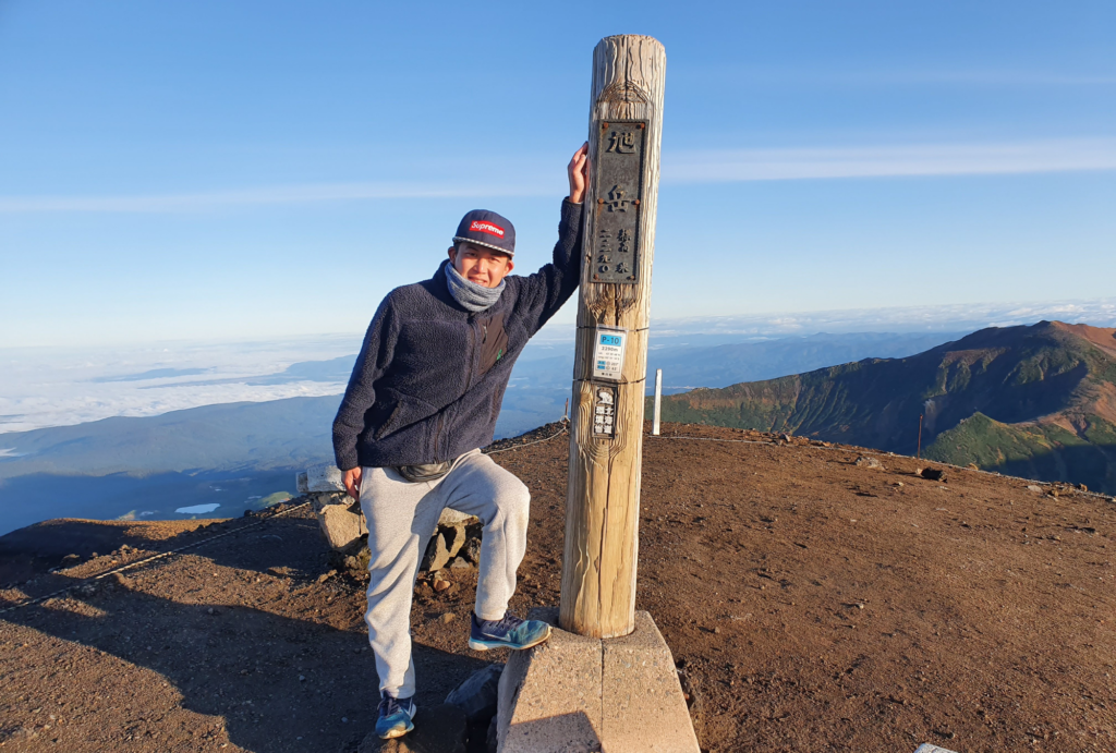
We woke up at 4am and hiked in the dark for 20 minutes to the summit of Mt. Asahidake to watch the sunrise.
There is a stone hut located around 20 minutes from the Sugatami cable car station. This hut is for emergency use only.
When first researching hiking in the Daisetsuzan, we were a bit overwhelmed with the amount of hiking routes available. Since there are so many access points to the national park and so many route options, we struggled to decide on which route to take. After a couple of days of deliberation, we eventually decided on the Nakadake-onsen route to the summit of Mt. Asahidake.

We would highly recommend taking this route if you have time since you can also visit the wild onsen. This route also has amazing scenery that is difficult to see if you only climb up and down Mt. Asahidake on the popular main route.
We also recommend camping overnight since it’s a really unique experience and watching the sunrise from the top of the mountain was incredible, even though it was freezing!